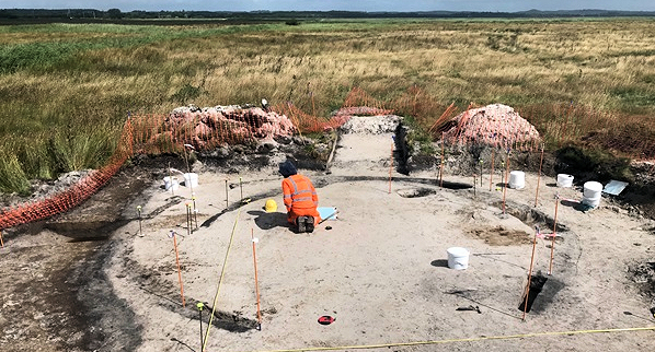
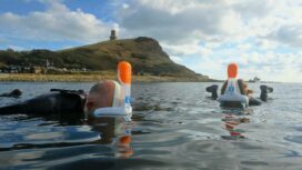
As part of a £10 million coastal protection scheme by the Environment Agency, a three year archaeological dig is to take place before 500 acres at Arne Moors near Wareham are flooded.
Archaeologists are keen to get started at the site along the Wareham Channel, after earlier trial trench investigations discovered Iron Age and Roman remains. It’s believed the area was first settled about 2,500 years ago.
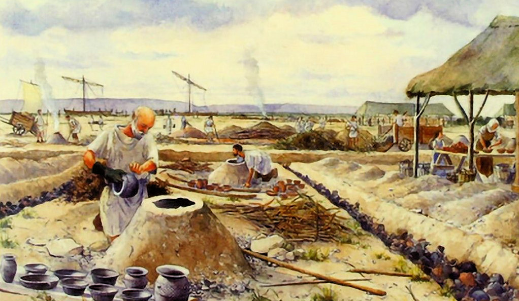
Artist’s impression of Roman pottery kilns on a site similar to the one at Arne Moor
New habitat for wading birds
The scheme to deliberately flood fields next to Poole Harbour, creating a new home for wading birds, is due to begin in spring 2023.
This is to compensate for loss of habitat due to the policy of protecting homes and property in Poole from flooding.
Construction of new tidal embankments will create a mosaic of salt and freshwater areas to attract a large variety of birds and wildlife, including water voles and sand lizards.
When the Moors at Arne nature reserve is complete, visitors will be able to enjoy the site’s new footpaths and bird-viewing points all year round to catch a glimpse of avocets, spoonbills and even cranes, alongside a host of other winter waders, which are expected to use the newly created wetland.
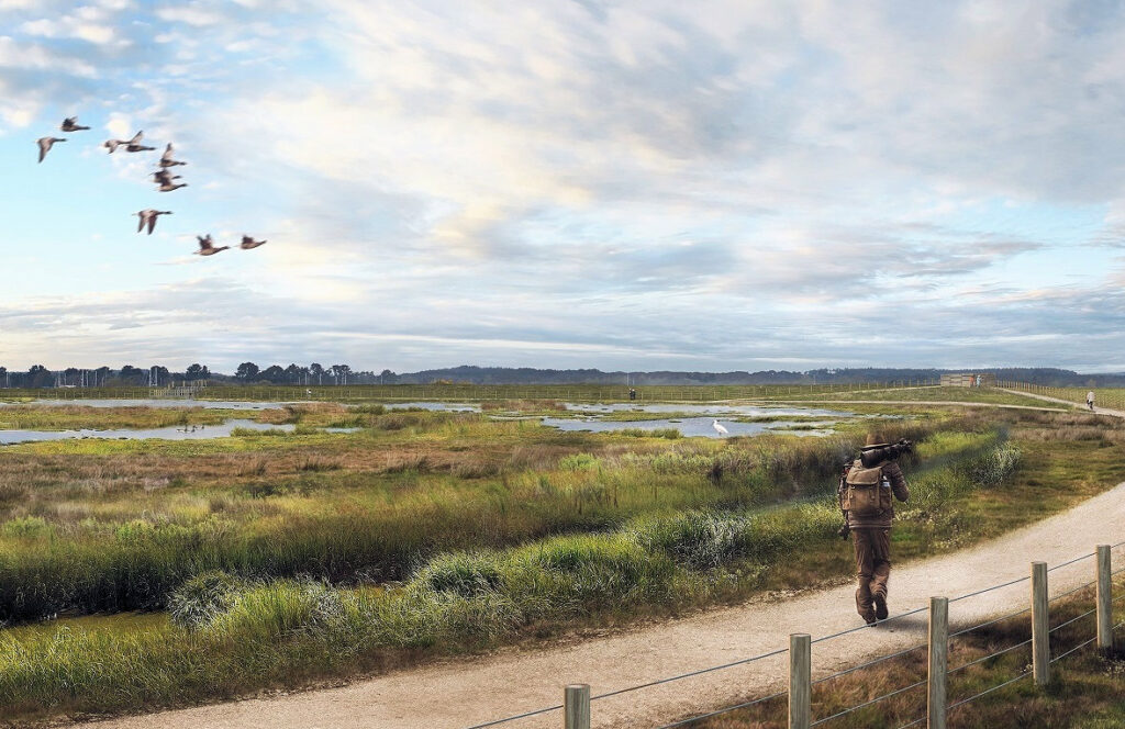
An artist’s impression of the £10 million wetland project at Arne Moors
First Purbeck settlers
But before the work by the Environment Agency can take place, experts from Wessex Archaeology think there are still major discoveries to be made from when the area was used as a centre to produce salt and pottery.
Trial trench investigations have already found three main areas of past human activity, the earliest on a small sand island, where it appeared that salt and pottery had been produced from the middle Iron Age, around 500BC, through into the Roman period 700 years later.
They also hope to be able to map the changing landscape of the Arne Peninsula through thousands of years, from carbon dated evidence which will be excavated during the three-year project – which will itself once more alter the geography of the area.
Any exciting finds will go on public display at Wareham Museum in the town’s high street, giving Purbeck locals the chance to better understand the area’s history.
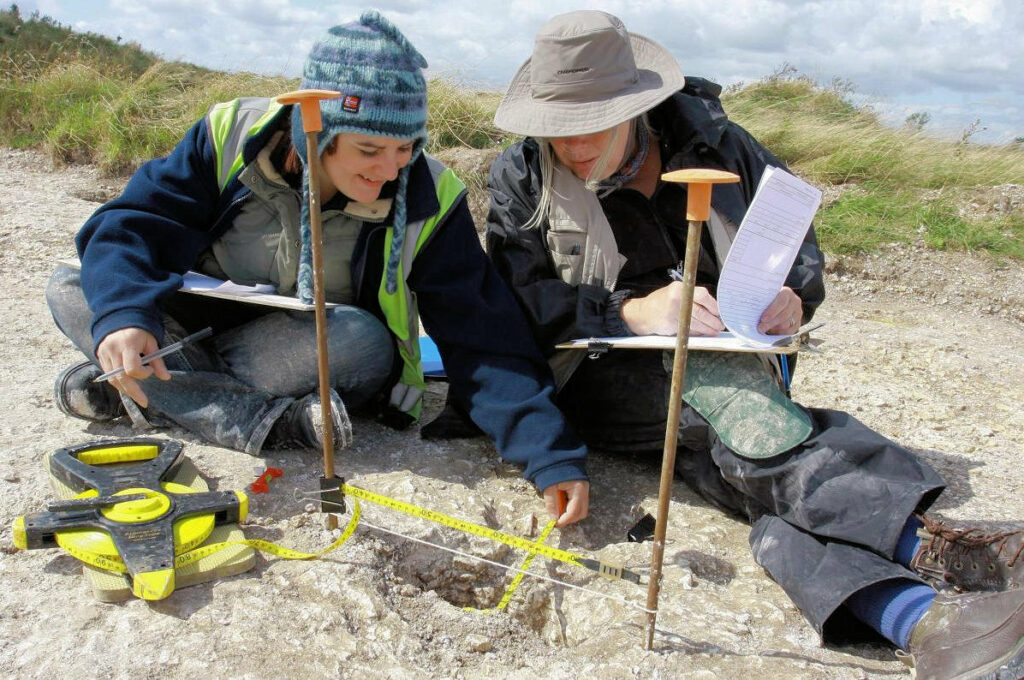
Wessex archaeologists hard at work to discover and decipher our history
Early signs of Iron Age settlement
Around the edge of the island, archaeologists found evidence of peat cutting dating from the same period, which may have been the fuel used for the salt and pottery production.
In another area of the site, on a low narrow sandy ridge, there was evidence of possible occupation in the form of several ring ditches, thought to represent the water drainage gullies around circular huts.
Although very few artefacts have been found so far, those that were recovered suggest the site was used in the later Iron Age and was possibly seasonal – and experts hope to recover many more artefacts in the next three years.
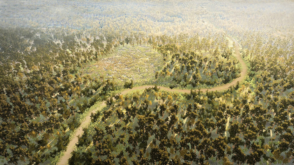
From geo-archaeology tests, this artist’s impression shows the Arne landscape at around 10,000BC
Area was used for salt and pottery production
Greg Chuter, Senior Archaeologist and Historic Environment Advisor at the Environment Agency, said:
“As part of the overall assessment of the site, Wessex Archaeology were commissioned to carry out a range of archaeological investigations, to better understand what survived below ground from the past.
“These investigations identified a fascinating story of a landscape that had changed on many occasions in response to climate change in the last 50,000 years. We also found evidence of how humans had interacted, utilised and managed this changing landscape.
“The most significant events were in the late Iron Age and Roman periods, when local communities used the drier areas of the site for salt and pottery production, and established a small settlement, possible for summer grazing of livestock and gathering of reeds for thatching.
“In the medieval and later periods, landowners began to drain the land to create more productive grazing land, and more recently, areas were made wetter to create wildlife habitat. Further archaeological excavation is planned to fully record the sites discovered.”
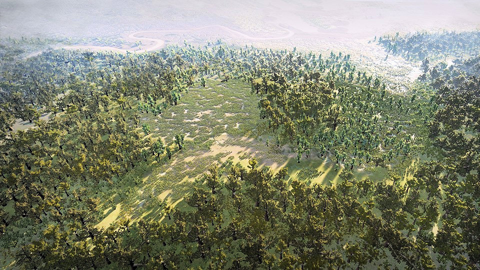
A landscape reconstruction of the site in Neolithic times around 6,000BC
Chance to study climate change in prehistoric Purbeck
Greg added:
“The discovery of these finds provides us with a fantastic opportunity to further investigate climate change in the prehistoric period, as well as late Iron Age and Roman activity around Poole Harbour.
“We intend to carry out further archaeological excavation and recording to learn even more about these sites and their history ahead of the construction activities taking place on site. We hope that as part of this archaeological investigation there will be opportunities for people to visit and see what we are finding.”
Through the use of geo-archaelology, samples from the site were radio-carbon dated and analysed to identify plant fossil remains, which has built up an understanding of past vegetation in the area.
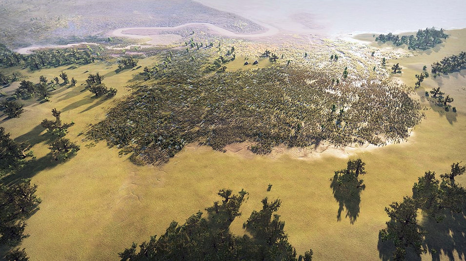
The Arne Peninsula as it would have looked about 100 years BC
Arne peninsula formed 2.5 million years ago
Findings showed that the site had formed in the Pleistocene period – which began 2.5 million years ago – when fluvial sands were deposited and then partly eroded by a developing river system.
The channels and hollows left by this erosion were then flooded and colonised by marsh environment plants, such as reeds, which slowly formed peat deposits, the earliest dating from around 10,000BC, with some areas still forming in the Roman period.
Within these peat marshes were higher areas of sands forming islands and ridges of dry ground, some of them settled by humans.
Samples also showed the landscape and environment of the site altered on several occasions in the past, thanks to both sea level rises and climate change.
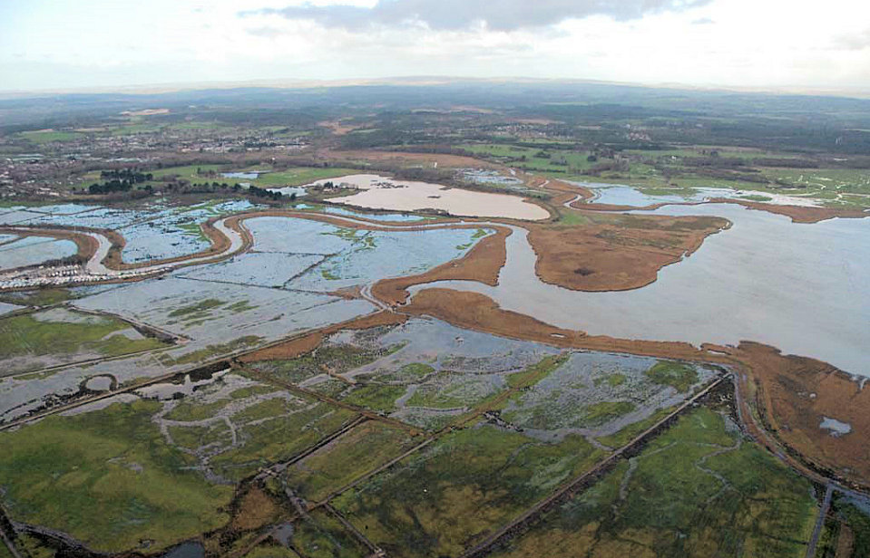
The Arne Peninsula as it is today at the mouth of the River Frome
Landscape changed several times by climate
At the end of the Ice Age, the landscape was covered with a birch dominated wood, replaced by pine woods around a small area of reed marsh, which by around 8,500BC had given way to a scattered broadleaf woodland, around areas of reed marshes.
Around 600BC, larger areas of reed marsh formed in response to an increase in rising sea levels. By the Roman period most of this woodland had either been cleared or died away due to rising water levels and forming the landscape we see today.
There is archaeological evidence of a small Roman settlement at Wareham, although the current town was founded by the Saxons.
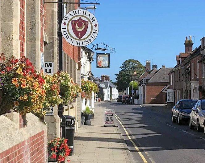
Any suitable discoveries at Arne will be showcased in Wareham Museum
Saxon Wareham housed two royal mints
The town’s Roman name is unknown, but it is referred to as Werham in the Anglo-Saxon Chronicle entry of 784, from the Old English wer (meaning ‘fish trap, or a weir’) and hām (meaning ‘homestead’).
Wareham’s oldest surviving features are the town walls, ancient earth ramparts thought to have been built by Alfred the Great in the 9th century in defence against the Danes, who invaded and occupied Wareham in 876, and only left after Alfred returned with an army and bribed them to go.
In 998 they attacked again, and in 1015 an invasion led by King Canute left the town in ruins, but by the end of the Saxon period in 1066, Wareham had become one of the most important towns in the county, to the extent that it housed two mints to issue royal money.
