Fascinating aerial photos have been newly published online by Historic England including hundreds capturing Purbeck from the skies over the last 100 years.
Public body, Historic England holds one of the largest and most significant aerial photography collections in Europe and is in the process of digitising them.

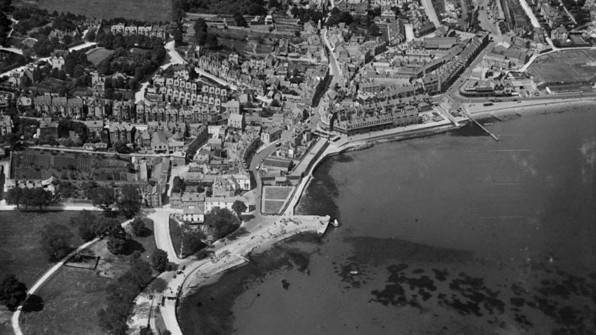
Swanage and the Downs on 1st June 1925
More than 400,000 images from across England
It has now created an online tool on its website to view more than 400,000 images from across England, which record how the country has changed from 1919 to the present day.
Around 300,000 of these are the work of Historic England’s Aerial Investigation and Mapping team. Established in 1967, the team takes photographs of England from the air to discover new archaeological sites, create archaeological maps and monitor the condition of historic sites across the country.
The remaining 100,000 images come from the Historic England Archive aerial photography collection and includes interwar and post-war images from Aerofilms Ltd and The Royal Air Force.
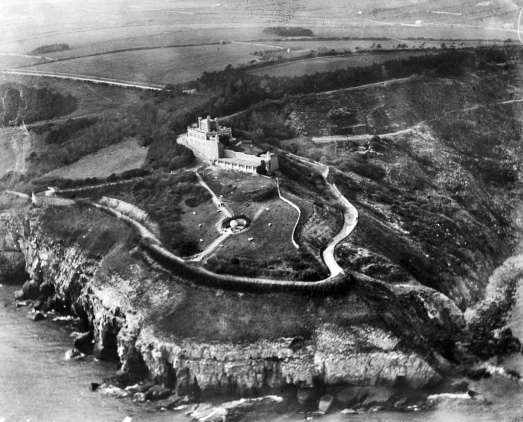
Durlston Castle on 1st April 1920
People will be able to research their local area
Historic England says it hopes that by opening up these photos to the public, it will allow them to research their local areas and potentially make new discoveries about where they live.
It’s also aimed at giving industry professionals and local authorities a useful resource to help planning, heritage projects and archaeological investigations.
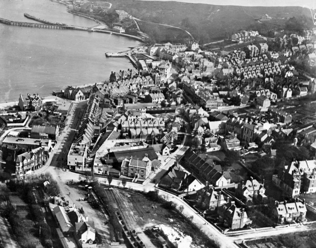
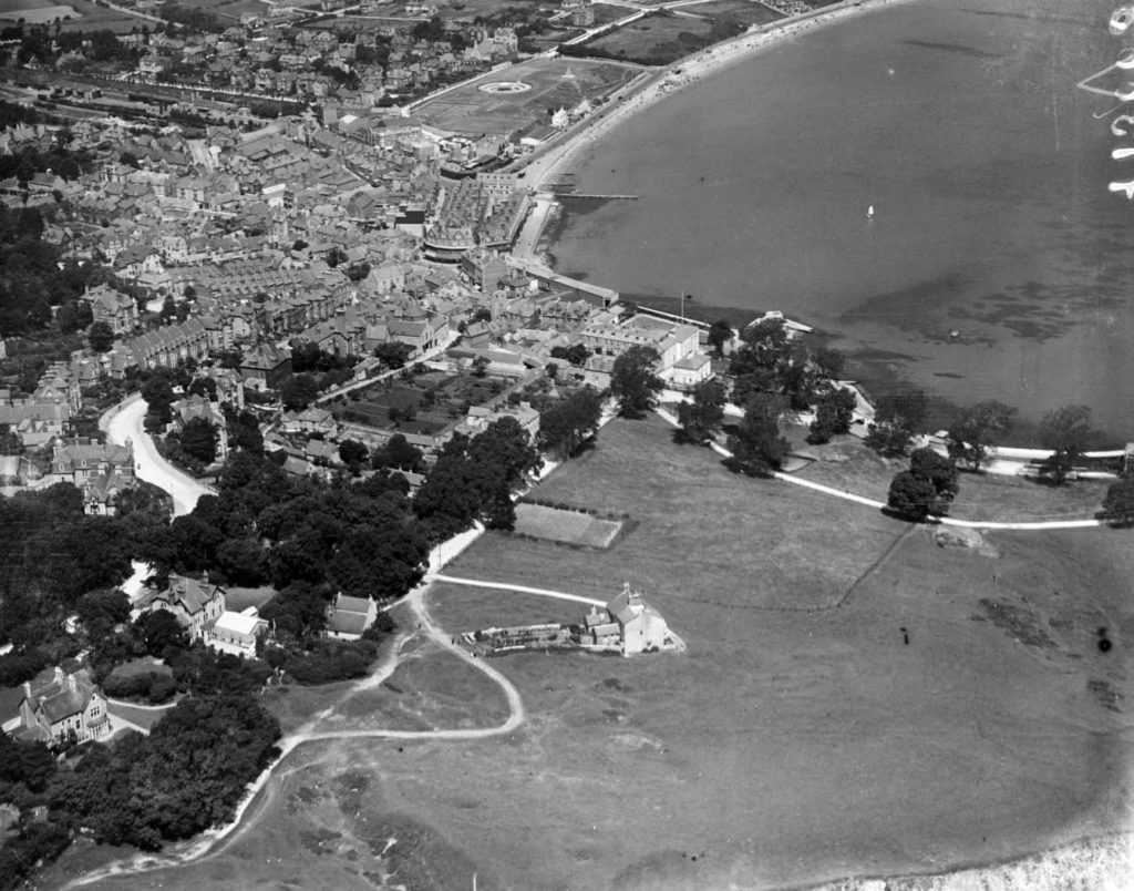
Swanage town centre on 1st April 1920
House building in Swanage has increased
The photos of Swanage show how house building has increased over the last century with more roads and homes appearing in the images as the years get closer to the present day. Some buildings like the Grosvenor Hotel disappear, while landmarks like the war memorial appear.
The photos also document Studland’s beaches, Corfe Castle, Wareham and Purbeck’s villages and fields.
This is just the start of the project and Historic England aims to add more images from its collection of more than six million aerial photos.
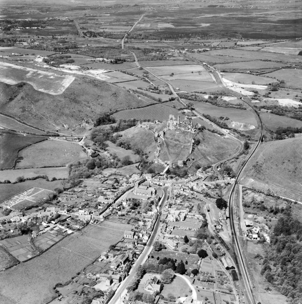
Corfe Castle pictured on 4th May 1953
“Unlock the mysteries of England’s past”
Chief executive of Historic England, Duncan Wilson said:
“I am delighted that our new online tool will allow people to access easily our wonderful collection of aerial images and enjoy the historic photography that our team uses every day to unlock the mysteries of England’s past.”
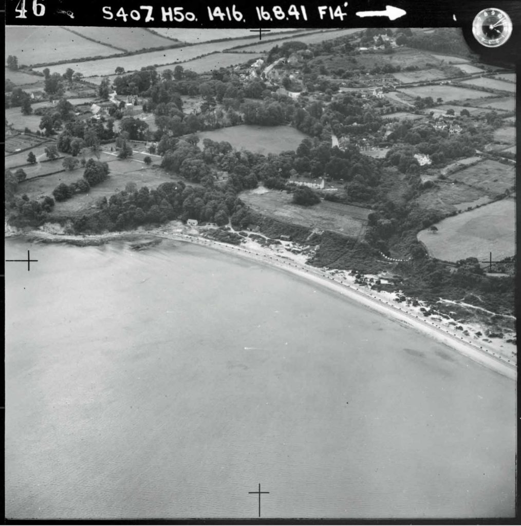
RAF aerial photo of Studland on 16th August 1941
View more images online
The photos are best viewed on a desktop computer but are available on a mobile phone. To access the Historic England aerial photo explorer go to its website
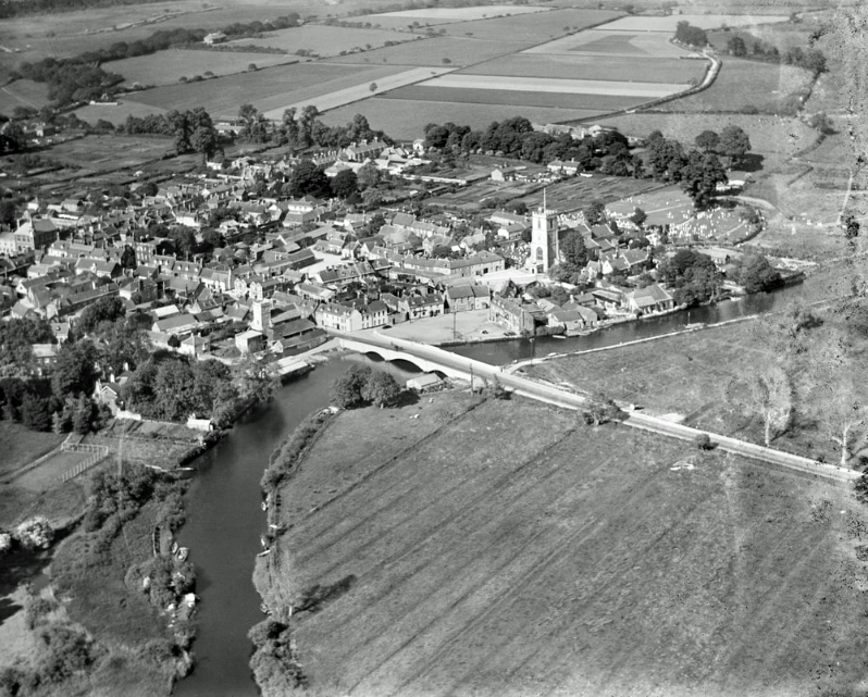
Wareham and the causeway photographed on 1st June 1930