Fields to the east of Wareham will be deliberately flooded over the next three years to create a new 500 acre habitat for wading birds which could become a sizeable tourist attraction.
Dorset Council has granted planning permission to the Environment Agency for the Arne Moors project, five years in the planning, which will permanently return grazing land to open water, to protect homes and property in the east of Poole Harbour from being flooded in the future.

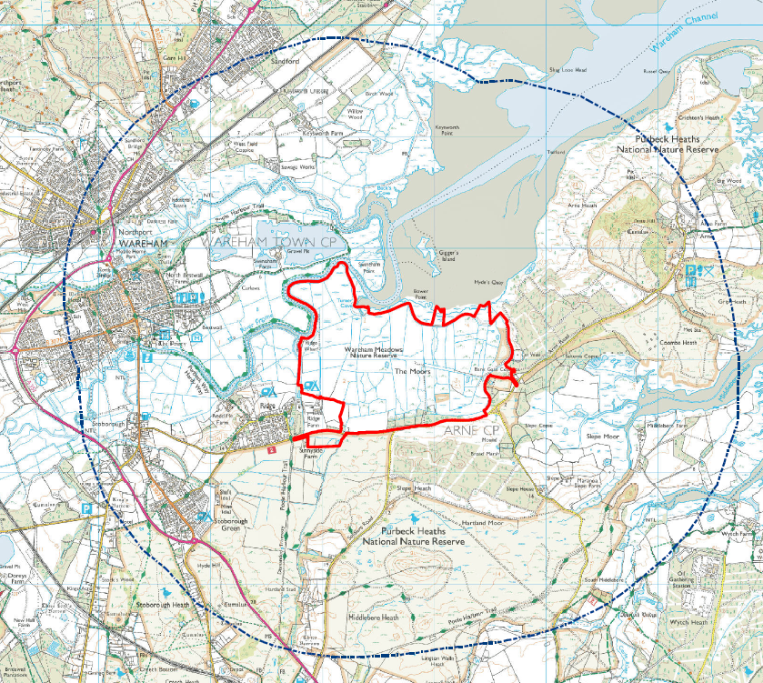
A map of the site of the Arne Moors marked out in a red outline, which will be changed from grazing land to open water by removing flood barriers
Wading birds to attract up to 22,000 tourists a year
Despite vocal opposition from many Purbeck residents and businesses, as well as from local MP Richard Drax who called it “nonsensical”, plans for the new wetlands centre were passed unanimously at a meeting of the Dorset Council eastern area planning committee on Wednesday 11th January 2023.
There were concerns from some councillors over the amount of car parking – just 15 existing spaces at Sunnyside car park and two new disabled spaces off Arne Road – which will have to cope with an estimated 22,000 tourist visits a year once the reserve is established.
Council officers have agreed to monitor the 500 acre site for 10 years after it opens to make sure that there are no problems either with parking or with visitors leaving their cars on the verges of narrow roads.
Under plans to breach existing tidal embankments and flood fields currently used for grazing and hay, new salt marshes, mudflats, tidal lagoons and reed beds will be created, along with a network of new embankments, paths and hides so that visitors can watch the bird life they attract.
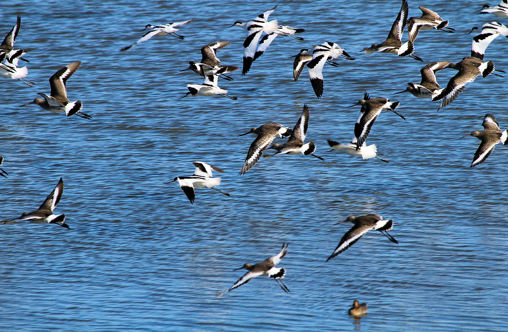
Avocets and godwits in flight over Poole Harbour – birds expected to flock to the new Arne Moors
Warmer summers may attract rarer visitors
Birds expected to arrive in numbers will include avocet – Poole Harbour is already one of the most important wintering site for them – godwit, shearwater, bittern, guillemot, stork, terns, sandpipers, curlew, dunlin and many more of the 333 species which have been recorded in the harbour.
Rarer visitors which may be spotted as climate change continues to increase the heat of summer may include Mediterranean gulls, spoonbills, cranes and cattle egret.
Steps will be taken to make sure that during the three years of construction, protected species already on site including otters, bats, badgers, sand lizards and birds that are currently using the landscape will not be harmed.
Otters, which are expected to lose some existing habitat, will have fresh water habitat on the new Arne Moors project created and enhanced, and the impact on protected species is thought to be acceptable in light of what is being created.
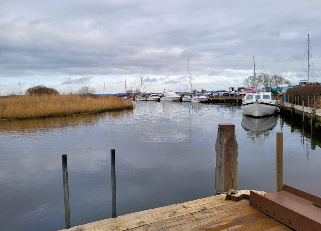
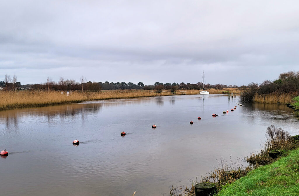
Looking out along the River Frome to land which will in future form part of the new nature reserve
A new coastal habitat to replace grazing marsh
Dorset Council case officer Naomi Shinkins told the meeting:
“The site is currently predominantly grazing marsh, dissected by an extensive network of drainage ditches which were historically constructed to drain the land and make it suitable for pasture.
“It is mostly owned and managed by the Royal Society for Protection of Birds (RSPB) for conservation purposes and is grazed and cut for hay in the summer months.
“The Environment Agency wants to create a new coastal habitat on the Arne Moors, necessitated by the 2014 flood and coastal erosion risk management strategy which recommends a ‘hold the line” policy for many parts of Poole Harbour to prevent homes and property from being flooded and from erosion.
“As a result of this policy, much intertidal habitat will be lost, as rising sea levels will destroy the existing habitats and new replacement habitats will not be formed due to the active intervention of the ‘hold the line’ policy.”
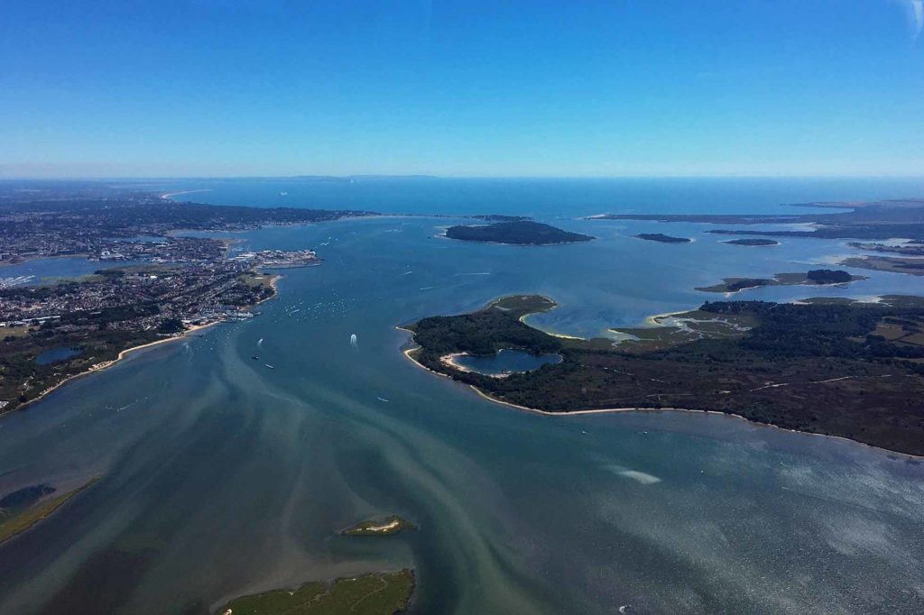
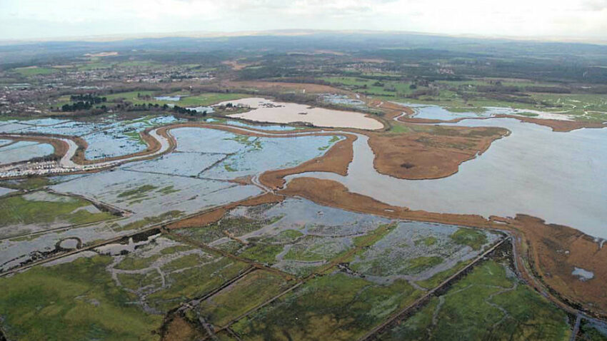
Ariel view of Poole Harbour, where sea levels are set to continue to rise
Environment Agency project executive Neil Watson said:
“This proposal addresses the impact of climate change, in particular rising sea levels. Poole Harbour has seen a significant change over the centuries – 2,000 years ago when the Romans used the harbour it was roughly a quarter of the size it is today with an average tide that was two metres lower than the present day.
“In the next 100 years as a consequence of climate change, we expect to see sea levels rise almost as much as they did in the last 1,000 years. This will have the effect all round the harbour of increasing the number of properties at risk from flooding from 675 now to 4,248 by 2110.
“The harbour wants to get bigger in response to the higher water levels. To stop this from happening, walls get higher and habitats like salt marsh, reed beds and mudflats are squeezed out.
“The Government has made the Environment Agency responsible for finding a replacement intertidal habitat in order that defences can continue protecting people and property from future flooding. The site at Arne Moors was the optimum and only practical solution within the harbour.”
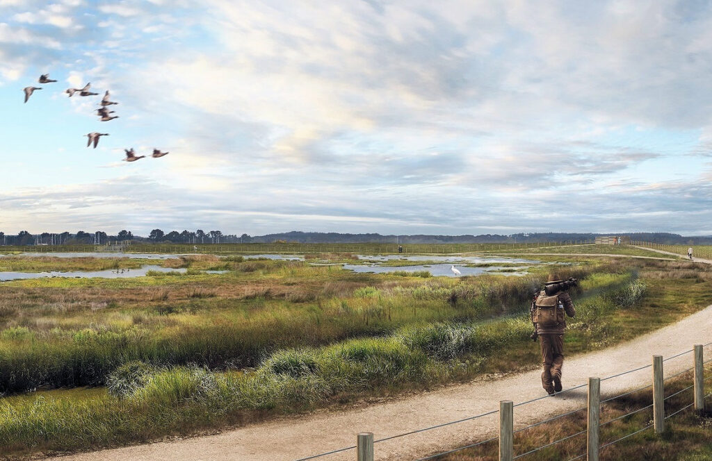
An artist’s impression of the new Arne Moors landscape after completion
Objections to ‘The Great Wall of Dorset’
It is likely to take three years to complete the new habitat east of the village of Ridge and north of Arne Road, creating new salt marshes and mudflats over 200 hectares (494 acres) by breaching some of the existing tidal embankments.
New embankments will be created along with footpaths and screened areas to allow visitors to watch the birds and other creatures which are expected to be attracted by the changes.
Discussions about the multi-million pound project started in 2017 and have included 12 meetings over the years with residents in Wareham, Stoborough, Arne and Ridge, as well as public exhibitions.
Some objections have described the proposed embankment south of the site as ‘The Great Wall of Dorset’ and a petition was signed by 24 residents worried about the impact of construction traffic and visitor parking for thousands of expected ecotourists each year.

South Dorset MP Richard Drax called the proposals ‘environmental madness’
“You really could not make this up”
South Dorset MP Richard Drax called it a madcap scheme and said:
“Of all the profligate and nonsensical applications that cross my desk as MP, this rates as the worst.
“On a vague reference to EU law the applicants claim they have the right to create this habitat for wading birds to replace land they say has been lost elsewhere, when 80 per cent of Poole Harbour is only a few feet deep.
“What strikes me as extraordinary is that the applicants intend to create a mud bund on a flood plain, paid for with flood protection money. You really could not make this up.
“The last thing this quiet piece of Dorset needs is convoys of lorries using a narrow land for access. If anyone but the RSPB had applied to do all this, they would have been turned down flat.
“This is environmental madness and pandering to strong lobbying from organisations that appear to get away with anything so long as it ticks the green agenda.”
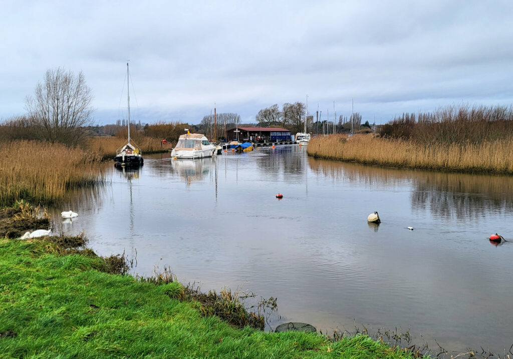
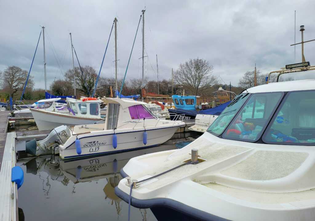
Redclyffe Yacht Club on the River Frome which it fears may silt up
Local boating businesses fear silting issues
Speaking for the Redclyffe Yacht Club, retired Commodore Mick Solomon said:
“It will not take a lot of silting for navigation of the lower Frome and upper reaches of the Wareham Channel to be seriously affected. The flood tide filling 150 hectares of Arne Moors means less water flowing into the Frome which will directly impinge on the viability of our club.
“Local businesses associated with boating and the town of Wareham will also be affected. Wareham receives thousands of visitors annually arriving in commercial tripper boats and private craft.
“Retailers in our town, already struggling, will feel the effect if navigation is seriously diminished. Many of our members also shop locally for ships’ supplies for their vessels.”
He added that the project team had refused to give Redclyffe Yacht Club a guarantee in writing that the scheme would not silt the lower reaches of the River Frome, on the grounds that they did not issue blank cheques.
Boating is an important source of revenue for the Wareham area
Increase in mosquito population unlikely
Objector Bob Day of Wareham said:
“As a boat owner on the River Frome I am greatly concerned that should this application be approved it will lead to greater silting of the already shallow river mouth to a point where the channel will no longer be navigable.
“This will effectively stop all boating activities on the river and have a serious effect on tourism in Wareham.”
Other objections raised included noise concerns for tourists staying in tents at the Ridge Farm campsite, which was dealt with by weekend limits placed on vehicle movements during construction, and an increase in the mosquito population, which the EA felt was unlikely to happen.
The RSPB, which has a reserve at Arne and owns most of the affected land, and Natural England have partnered with the Environment Agency throughout the project.
Landscapes along the River Frome will change dramatically over the next three years
Site of six Bronze Age round houses
An Environment Agency spokesperson said:
“During the construction, the new tidal embankments and site features on the existing moors will be created first and then the three proposed breaches will be opened to the tidal water.
“It is not expected that this method of habitat creation will lead to outflow of silt into the Frome and the wider harbour.
“When the project has been completed the indication is that incoming sediment at high tide would naturally settle within the realignment site to create the features such as mudflats, fresh water ponds and saltmarsh.”
Historic England date the site to the early Mesolithic period. Significant finds over the years include axes from Cornwall, six Bronze Age round houses and evidence of later Roman and Saxon occupation including graves, cremations, a coin hoard and more than 30 kiln structures.
Further information
- The full planning application P/FUL/2022/05149 is on the Dorset Council website